São Jorge is a long narrow ridge of dramatic basalt cliffs, 54 kilometres east to west and barely 7 wide. The cliffs drop straight into the Atlantic, except where ancient landslides have created the fajãs: flat coastal platforms a few hectares wide that became the only viable farmland on the island. The fajãs grew vines, the upper ridge raised cattle, and today the island is best known for the DOP cheese the central plateau produces and the trail-running terrain the coastal escarpment offers.
São Jorge is the long, thin island of the central group, a 54-kilometre ridge of basalt cliffs that drops into the Atlantic. The map shape is a knife laid east to west. The cliffs are 400 to 700 metres tall on both coasts. Where ancient landslides have torn off pieces of the cliff face, flat platforms of debris (fajãs) sit at sea level under the towering escarpment. Most of the island’s human history happened on those fajãs.
This guide covers what to expect, the fajãs, the cheese, the ferry connections, and how to plan a stay of 2 to 4 days.
Why São Jorge
São Jorge rewards travellers who walk. The island has more descended-fajã trails than anywhere else in the archipelago, the ridge spine offers the longest continuous high-altitude walk in the Azores, and the back-roads through the central plateau are quiet enough to drive without seeing another car.
It is the wrong pick for travellers who want polished tourist infrastructure or beach time. There is one swimming beach on the island. The accommodation choice is narrow. Many restaurants close at 9pm. The compensation is genuine isolation: you can hike a fajã trail in May and meet no one.
São Jorge works best as the third leg of a central-group triangle trip (Pico + Faial + São Jorge), or as a standalone destination for hikers and trail runners.
Geography and climate
São Jorge is a single long volcanic ridge formed by aligned fissure eruptions. The most recent surface eruption was 1808, on the western end. The two main towns sit on the western coast: Velas is the larger and the ferry port, Calheta is the eastern town. Urzelina on the south coast is a smaller village. The ridge spine peaks at 1,053 metres (Pico da Esperança).
The fajãs are scattered along both coasts, with the densest concentration on the north side between the villages of Norte Pequeno and Topo. Several are accessible only by foot or boat; others have small road access via switchback descents from the ridge.
The climate is the wettest of the central group (around 30% more rainfall than São Miguel). The ridge spine traps the cloud, so the coastal villages can be sunny while the upper plateau is in fog.
Top experiences on São Jorge
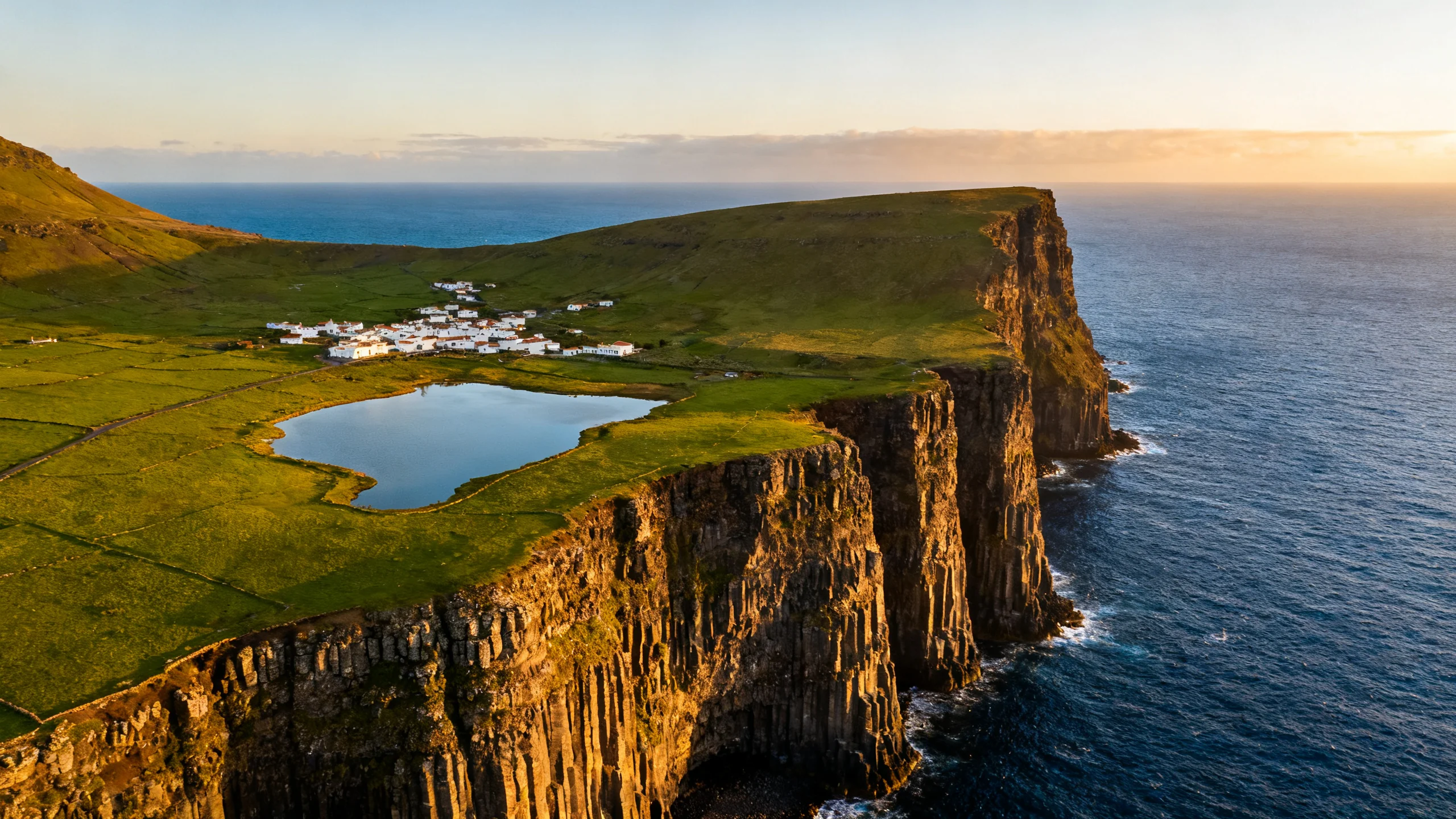
Fajã dos Cubres. The most accessible fajã. A salt-water lagoon behind a black-pebble beach, a small white-painted village of 8 houses, a single café. Reached via road descent from the EN3 ridge road, 25 minutes from Velas. Walk the perimeter of the lagoon, eat fresh fish at the café, drive back up. See the fajãs of São Jorge guide for the detail.
Fajã da Caldeira de Santo Cristo. The most distinctive fajã. A lagoon with the only wild clam fishery in the archipelago, plus a small reef break that is one of the best surf spots on the central plateau. No road access; descend via the PR1 SJO trail from the ridge, around 60 minutes down, 90 up.
São Jorge DOP cheese. The only DOP cheese in the Azores. A hard cow’s milk cheese aged 12 to 24 months, sharp and slightly piquant. The Uniqueijo cooperative in Beira offers tastings and direct purchase (€18 to €25 per kilo). See the Azorean cuisine guide for the broader context.
The Pico da Esperança ridge trail. A 16-kilometre ridge walk along the spine of the island at 700 to 1,053 metres altitude. Continuous views over both coasts on clear days. Trail-marked PR 2 SJO. The full traverse is point-to-point (logistically requiring a shuttle); most walkers do an out-and-back of the central section.
Velas town circuit. A 1-hour walking circuit through the small ferry-port town: the small fortress (Forte de São Jorge), the seafront promenade, the Igreja Matriz de Velas, the small market on Saturday mornings. Velas is small (1,500 inhabitants) but pleasant.
Whale and dolphin watching. Less famous than Lajes do Pico or Horta, but São Jorge’s eastern Velas coastline faces the same deep-water channel. A few small local operators run boats. Less frequent than the main central-group hubs.
Where to base yourself
Velas is the practical answer for most visitors. The ferry port, most accommodation, the largest restaurant choice, the airport is 8 km away. Drive times: 25 minutes to Fajã dos Cubres, 40 minutes to Calheta, 50 minutes to the eastern fajãs.
Calheta on the eastern coast is the alternative for travellers who want the smaller-village feel and easier access to the eastern fajãs.
Rural casas on the central plateau and around the smaller villages offer the off-the-beaten-track experience but require a rental car.
The dedicated where to stay on São Jorge guide breaks down the choice.
Getting to São Jorge
São Jorge Airport (SJZ) is the smallest commercial airport in the central group:
- Lisbon (LIS): TAP, 3 weekly seasonal, 2h30.
- Terceira (TER): SATA, 4 to 5 weekly, 30 minutes.
- São Miguel (PDL): SATA, 3 to 5 weekly, 50 minutes.
- Faial (HOR), Pico (PIX): SATA, 1 to 3 weekly each, 15 to 30 min.
The Atlanticoline ferry is the most useful option for visitors combining São Jorge with the central group:
- Velas ↔ Horta (Faial): 1 to 2 daily summer, 90 minutes, €15.
- Velas ↔ Madalena (Pico): 1 to 2 daily summer, 90 minutes, €15.
- Smaller summer service to Calheta from Pico’s São Roque.
Inter-island ferries to São Jorge are more weather-sensitive than the short Faial-Pico crossing. Build a buffer day if you depend on the ferry for your return.
See how to get to São Jorge for the detail.
Getting around
A rental car is essential. The island is too long for taxis, the bus network is school-schedule limited, and the fajã descents require trail access from points on the EN3 ridge road.
Companies: Ilha Verde and local operators at SJZ airport. Compact car €30 to €70 per day. Reserve well in advance for July and August (fleet is small).
The single ring road (EN1 and EN3) is 130 kilometres, drivable in 2.5 hours without stops. Add 30 to 60 minutes for each fajã descent side trip.
Suggested itineraries
2 days, light. Day 1: arrival in Velas, town walk, drive to Fajã dos Cubres for the afternoon. Day 2: ridge drive across the plateau, lunch at Pico da Esperança, afternoon at Fajã da Caldeira de Santo Cristo (descend on foot).
3 days, full. Days 1 to 2 as above. Day 3: the eastern half of the island (Topo, the eastern fajãs, the lighthouse), or the Pico da Esperança ridge traverse.
4 days, hiker. Days 1 to 3 as above. Day 4: the full Pico da Esperança ridge walk (point-to-point with shuttle), or the multi-fajã descent from Norte Pequeno.
Best time to visit
- May to June: the best month for hiking. Hydrangeas in bloom along the EN3, weather stable, fajã trails dry.
- July to August: peak summer, warmest water on the south coast, surfing at Fajã da Caldeira de Santo Cristo.
- September to October: quieter, cheese-festival window, ridge walks still excellent.
- November to April: off-season. Ferry sailings reduced, several restaurants closed, the fajã descents are slippery in rain. Worth it only for the truly off-season experience.
Frequently asked questions
What is a fajã exactly?
A flat coastal platform formed when a section of cliff collapsed into the sea, leaving the debris as a low flat shelf at the foot of the remaining cliff. On São Jorge there are over 70 named fajãs, ranging in size from a hectare to several dozen. Some are inhabited, others are wild, several have lagoons. The geological process is the same as the smaller fajãs on Pico and Flores, but the São Jorge cliffs are taller so the fajãs are more dramatic.
Is the cheese worth the visit?
For cheese lovers, yes. The 12-month aged São Jorge DOP is the benchmark, with a sharp tangy character that comes from the volcanic pasture and the controlled aging in basalt-stone cellars. The 24-month aged is genuinely intense (compared to Italian Parmigiano by some tasters). Available at the Uniqueijo cooperative shop in Beira, €18 to €25 per kilo, vacuum-packed for travel.
Are the fajã descents technical?
Not technically (no climbing or ropes) but sustained. A typical descent is 300 to 500 metres of vertical drop on a marked trail, usually 45 to 75 minutes down, 60 to 90 minutes back up. The climb back is the harder half. Good walking shoes are essential, hiking poles useful. The trails can be slippery in wet weather.
Can I combine São Jorge with Pico and Faial?
The central-group triangle is the classic Azorean walking trip. 8 to 10 days, ferry between the three islands, see each at its own pace. Plan around the ferry schedule rather than the flight schedule; the Velas sailings are less frequent than Horta-Madalena and more weather-sensitive.
Are there beaches?
One proper beach (Praia da Faja Grande, a small black-sand cove on the south coast) plus several pebble-beaches on the fajãs. The beach culture is limited. São Jorge is a hiker’s island, not a swimmer’s.