Hiking trails in São Miguel
São Miguel has more than thirty officially marked trails, ranging from family-friendly 30-minute loops to full-day climbs through the cloud forest. This is a ranked, opinionated selection, ten that cover the geological highlights of the island, with honest notes on difficulty and what each one actually delivers.
Quick orientation
The official trail network is signposted as "PR" (Pequena Rota,
small route) and "PRC" (Pequena Rota Circular). All trails are
marked with red-and-yellow paint blazes and signposts at junctions.
Maps and GPX tracks are available free at
trails.visitazores.com.
Conditions: the Azores are wet. Even in summer, a trail can switch from sun to fog to drizzle and back inside an hour. Bring a waterproof jacket year-round. Boots (not trainers) are recommended for trails longer than 4 km; the volcanic terrain ranges from packed dirt to loose lava, and the moss-covered sections are slippery.
Time: the official "duration" on signposts assumes a steady pace with no photo stops. Add 30–50% for a real-world time if you want to take in the views.
By difficulty
Easy (under 5 km, minimal elevation)
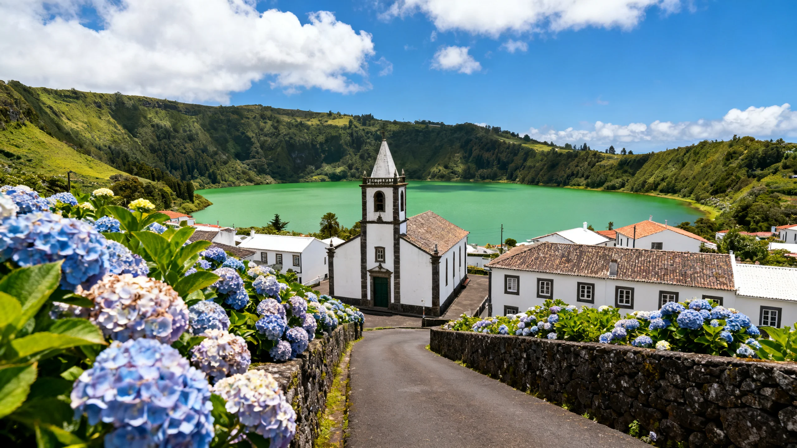
1. Lagoa do Fogo – northern shore loop (PRC02 SMI)
4.7 km circular, 1h30, easy. The descent from the ER1-1A roadside lookout down to the northern shore of Lagoa do Fogo, a walk along the lake, and a return up the same path. The lake is the youngest crater lake on the island and one of the most pristine, no road, no buildings, no fishing, and the path is the only legal way in.
Conditions: well-marked dirt path, mostly downhill on the way in (which means uphill on the way out). The lake itself is shallow at the shore but gets deep quickly; swimming is discouraged but ubiquitous in summer.
2. Caldeirões park trail
2.5 km loop, 45 min, easy. A short walk through a ravine of waterfalls and pools, in the east of the island. The trail is paved with wooden boardwalks and is wheelchair-accessible on the easier sections. Same area as the canyoning operators run their tours, but the walking path is separate and free.
3. Furnas village circuit (PRC03 SMI)
3.4 km circular, 1h, easy. A loop through Furnas village taking in the caldeiras (geothermal mud pots), the central square, the public gardens, and the Lake Furnas viewpoint. Useful as an orientation walk after arriving in Furnas. No climbing involved, paved underfoot.
Moderate (5–10 km, some climbing)
4. Sete Cidades – Vista do Rei to Boca do Inferno
8 km return, 3h, moderate. The classic Sete Cidades rim half-loop. Start at Vista do Rei (the standard postcard viewpoint), follow the western rim of the crater around to Boca do Inferno (the highest viewpoint, looking down into both lakes at once), and retrace. The rewarding part is concentrated at the two endpoints; the middle section is pleasant but uneventful.
Conditions: well-marked, generally easy underfoot. One section near Boca do Inferno is steeper. Fog can roll in quickly and reduce visibility to nothing, check the live webcam before driving up.
5. Praia – Sanguinho – Salto do Prego loop
7 km circular, 2h30, moderate. One of the most rewarding hikes on the island. Starts in the village of Faial da Terra, climbs through laurel forest to the abandoned village of Sanguinho (a partially restored cluster of stone houses), continues to the Salto do Prego waterfall (where you can swim), and descends back through forest. Atmosphere very different from the better-known west-island trails.
6. Janela do Inferno
8 km return, 3h, moderate to demanding. A trail descending into a steep ravine east of Furnas, named after a "window" viewpoint above the valley floor. Less well-known than the Sete Cidades or Lagoa do Fogo walks, often almost empty. The reward is a hidden valley with multiple waterfalls and unusual silica formations.
Conditions: the descent is steep and slippery in places. Footwear matters. The return climb is the harder half; budget more time than the signposts suggest.
7. Mata-Jardim José do Canto – Lagoa das Furnas circuit
9 km circular, 3h, moderate. A loop around Lake Furnas, starting from the Caldeiras (where the cozido pots are buried) and passing through the José do Canto landscape garden, the Nossa Senhora das Vitórias chapel, and the woodland on the south shore. Easier than its length suggests because the elevation gain is modest, and it combines naturally with a Furnas day.
Demanding (10+ km or significant climbing)
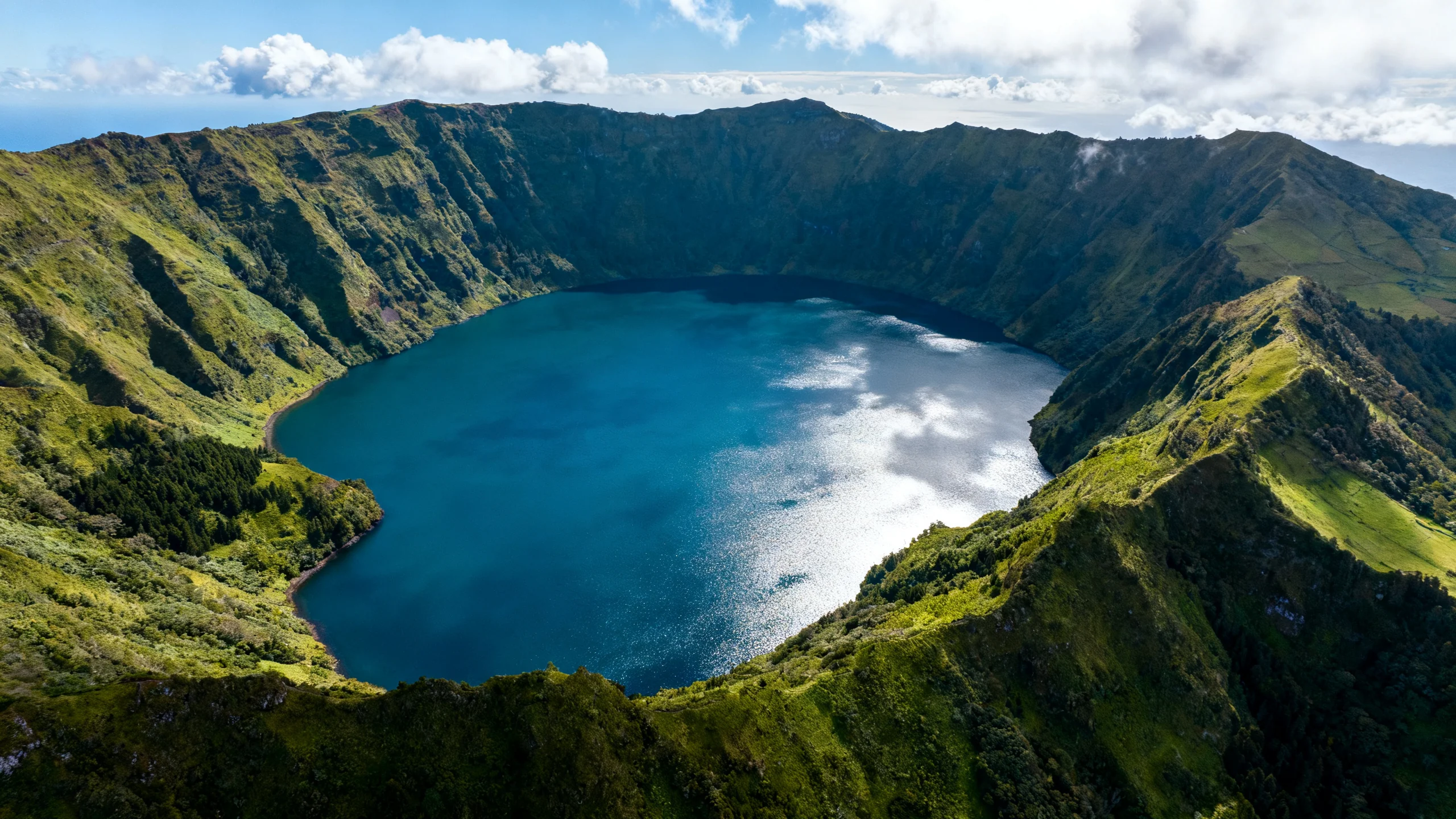
8. Sete Cidades full crater rim
12 km circular, 5h, demanding. The full loop around the Sete Cidades crater, both rims, the village in between. The western half (less visited) is overgrown in places and the views are not as good as on the eastern half. Most hikers do the half-loop (trail #4 above) and skip the western section.
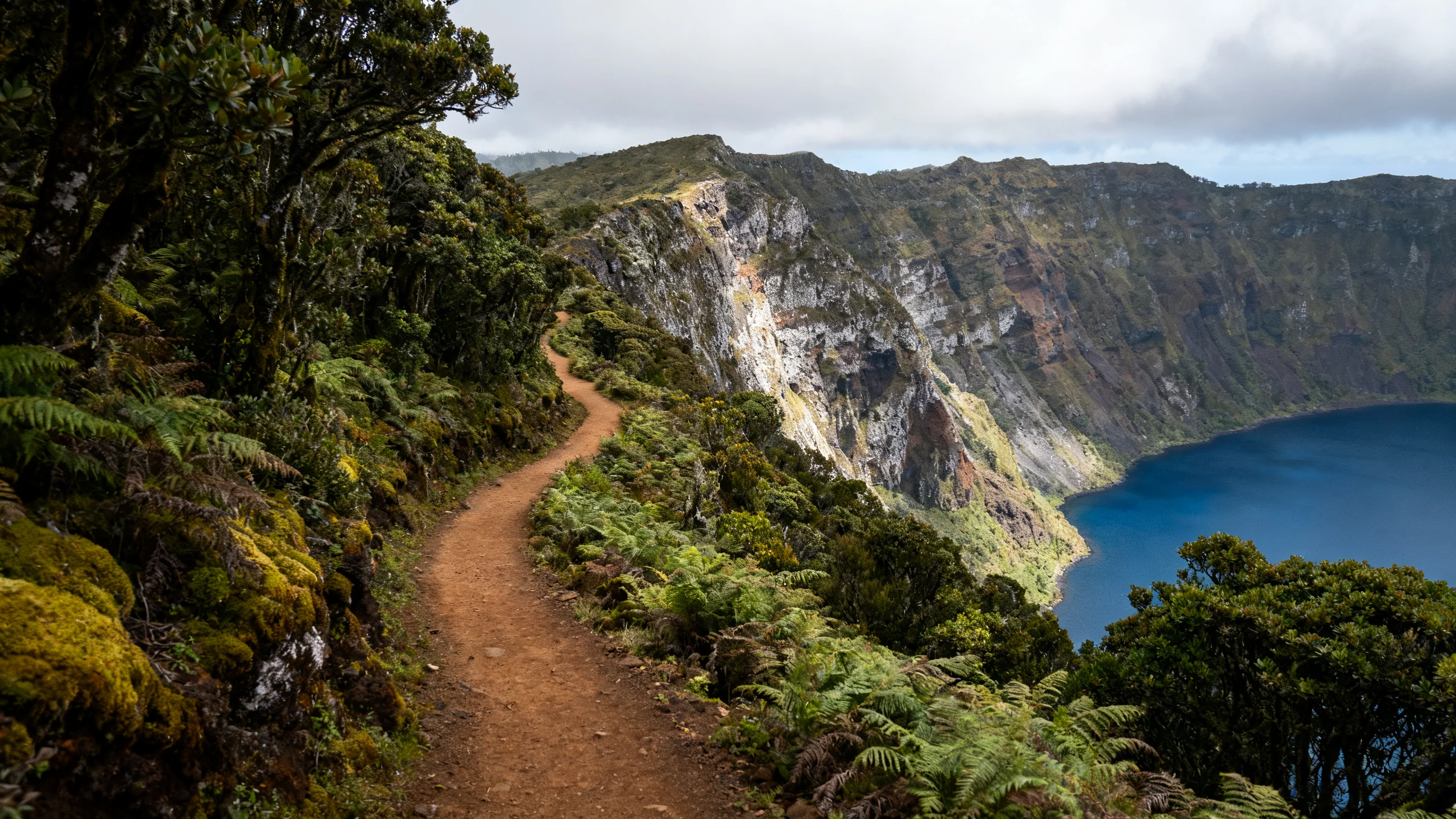
9. Pico da Vara
9 km return, 4h, demanding. Climb to the highest point on the island (1,103 m), in the eastern Nordeste region. The trail traverses laurel forest, then enters the cloud zone before emerging at the summit. The summit is bare and exposed; in fog (which is most days), you see nothing.
Conditions: the trail is steep and rough underfoot in places. The summit area is the only nesting habitat in the world for the priolo, the endangered Azorean bullfinch, and access is regulated during nesting season. Check current rules before going.
10. Tronqueira – Pico da Vara linear traverse
11 km point-to-point, 4–5h, demanding. A longer version of #9, traversing the laurel forest along the spine of the Tronqueira mountain range. Best as a one-way hike with a return transfer arranged in advance. Some of the best preserved laurel forest in the archipelago, several priolo sightings reported.
How to do these without a car
Most of these trails have no public bus access. The realistic car-free options are:
- Join an organized hiking tour. Several operators run guided walks on Sete Cidades, Lagoa do Fogo, and the Salto do Prego loop, including hotel pickup from Ponta Delgada. Group sizes 6–12, half-day to full-day, typically €40–80.
- Taxi from Ponta Delgada to the trailhead. A round trip to Sete Cidades is €50–70 (the driver waits or returns). Reasonable for a half-day hike; less economical for the full-day options.
- Combine with a full-day van tour. The West São Miguel full-day van tour and the East São Miguel full-day van tour include light walks (under 2 km) at several of the locations mentioned above, but not the longer trails, they cover ground for travellers who prefer driving with stops.
Weather and timing
The best months for hiking are May, June, September, and early October, long daylight hours, warm but not hot, manageable rainfall. July and August work too but the higher trails can be sweaty in midday sun. November to March is hikable but wetter; some trails near the summits become impractical due to fog and slippery moss-covered rock.
On any given day, the western and central parts of the island are often drier than the eastern Nordeste. If the forecast is grim for the east, switch to a Sete Cidades trail; conversely, on the rare days when the west is in cloud and the east is clear, head to Janela do Inferno or the Faial da Terra loop.
Equipment list
- Boots with ankle support for any trail over 5 km. Trail runners work for the easier loops but slip on wet basalt.
- Waterproof jacket, even in summer.
- Layers, at 800m+ elevation the temperature is often 6–8 °C cooler than at sea level.
- Water. Most trails have no water sources you can drink from.
- Downloaded offline map, phone signal drops out on the longer trails.
- Hiking poles for the longer descents (Janela do Inferno, Lagoa do Fogo return climb).